Home / 3D Satellite Overhead Maps
Satellite photorealistic maps are drawn specifically to be overlaid over North-facing satellite maps for use in the CampusTours AnyMap™ platform. Drawing custom 3D map artwork over satellite maps allows organizations to take advantage of all of the positive aspects of popular satellite map systems (Driving, Biking & Walking Directions, StreetView, GPS, Satellite/Roadmap view) while entirely eliminating the negative aspects (slow updates of recent campus construction, poor visibility for some structures/paths due to tree cover, unappealing looking structures, etc)
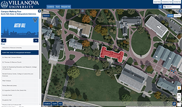
Villanova University implements a custom satellite 3D overhead map and a guided panoramic campus tour.
HVCC utilizes the AnyMap service with a custom 3D satellite map, Vimeo videos and panoramic images.
Founded in 1997, CampusTours provides software to hundreds of organizations worldwide to maintain virtual tours and interactive maps.
Copyright 2024 © All Rights Reserved Design by CampusTours